 閲覧支援を閉じる
 行政放送
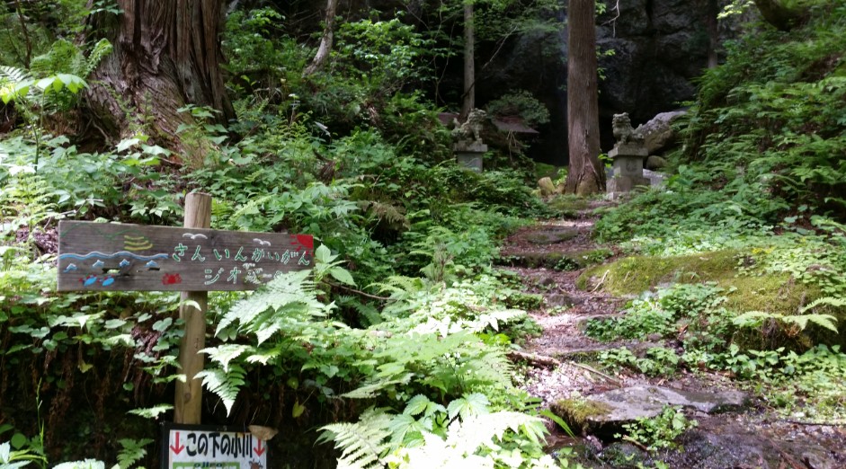
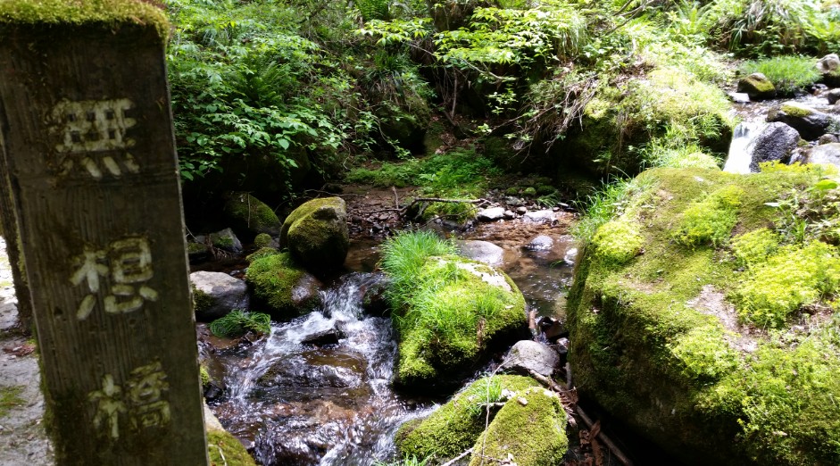
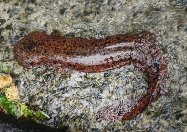
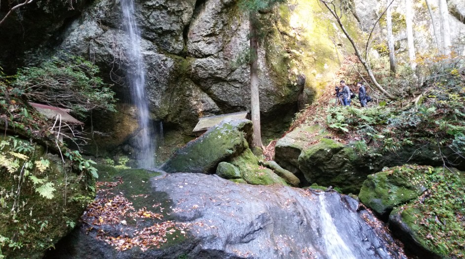
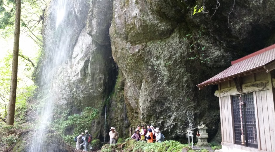
行政放送Yoshi Falls have been confirmed to have giant salamanders along the Kusube River downstream, and is recognized as having great value as a habitat. In addition to the natural beauty and landscape, it has become a cultural asset of academic value.
Designated date
3 March 24, 1972
Type
Historical Site Natural Beauty
Location
Kajiya, Ojiro-ku, Kami-cho
Specification
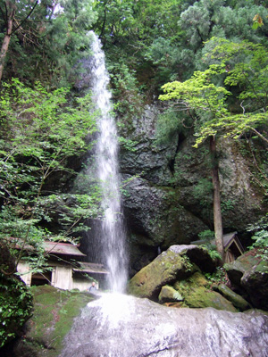
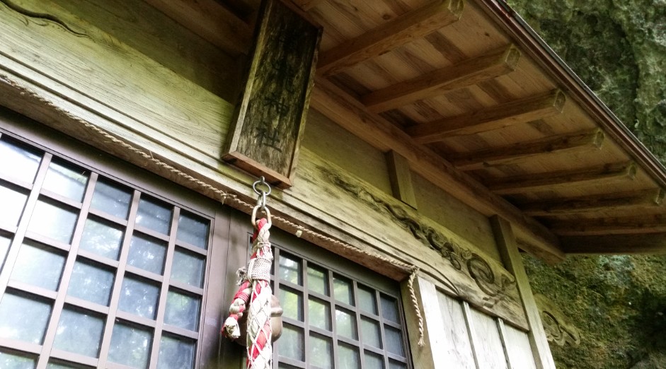
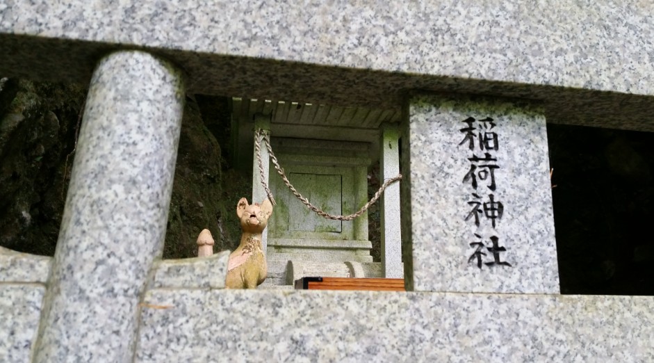
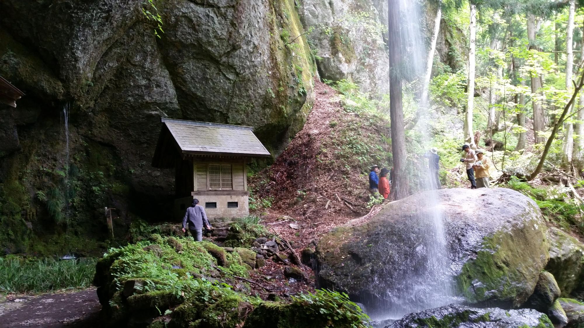
The height of the waterfall is 28 meters (1st waterfall [23 meters], 2nd waterfall [5 meters]), and Yoshitaki Shrine is erected behind the waterfall.
Urami Falls(Waterfall seen from behind) are rare in the prefecture and delight visitors.
It is 15 meters from the waterfall basin to the back of Yoshitaki Shrine, and is very delightful as a cool place in summer, etc. There are commonly known gold falls (5 meters) and silver falls (8 meters) on the left and right.
There is a mysterious waterfall where gold and silver powder can be seen.
There are about 10 tochi trees (maximum root circumference 7.6 meters) and 4 zelkova trees (maximum root circumference 4 meters) around the waterfall. Autumn leaves are a wonderful scene.
Map of Yoshi Falls の地図
Kajiya, Ojiiro-ku, Kami-cho, Mikata-gun, Hyogo Prefecture
この記事に関するお問い合わせ先
教育委員会 生涯学習課
〒667-1392
兵庫県美方郡香美町村岡区村岡390-1
電話番号:0796-94-0101
お問い合わせ
- みなさまのご意見をお聞かせください
-